
Maps
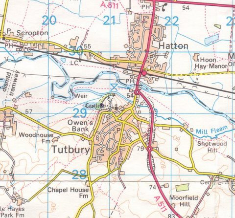
The centre of Tutbury is at National Grid Reference SK 2136 2840
|
Tutbury & Burton |
|
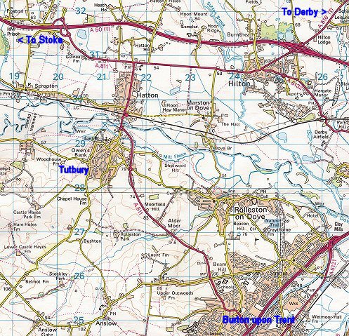
Tutbury & Hatton |
|
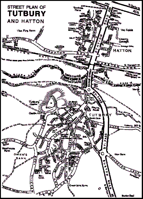
Street map of village |
|
|
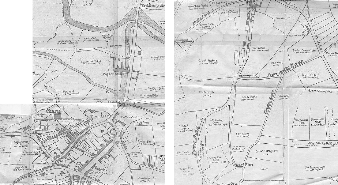
Old Tutbury Map 1641 |
Detailed street maps may be found at www.streetmap.co.uk, www.multimap.com and Google Maps
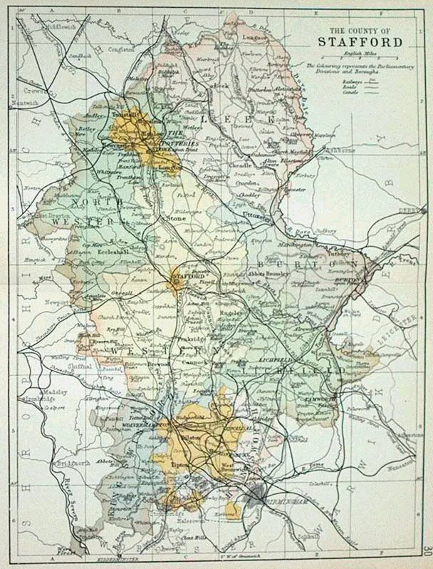
Some Old Staffordshire Maps |
|||
|---|---|---|---|
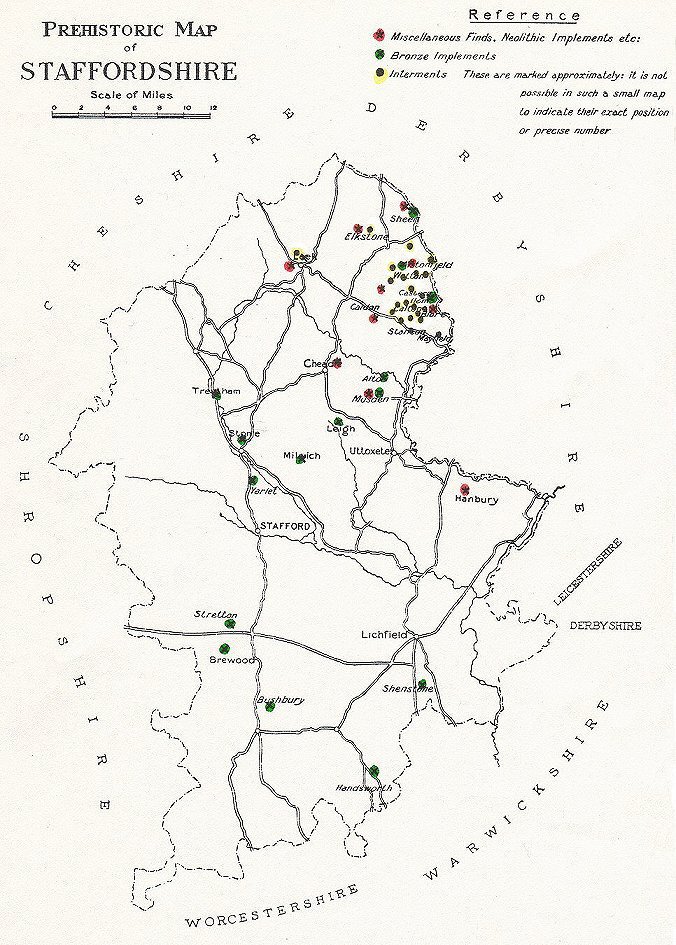
Pre-historic Staffs |
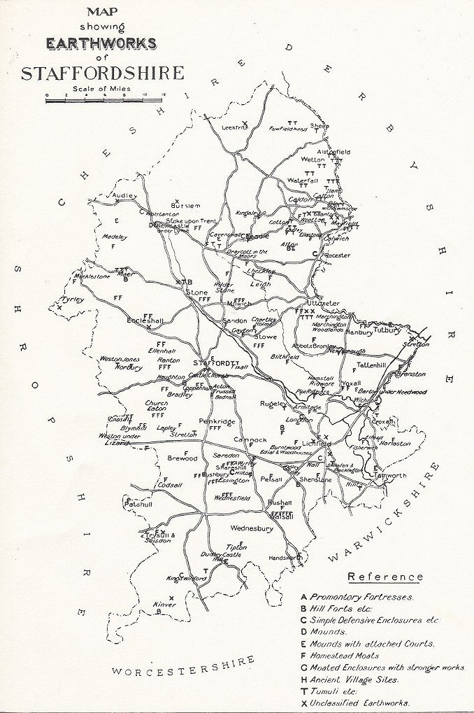
Earthworks |
Anglo-Saxon |
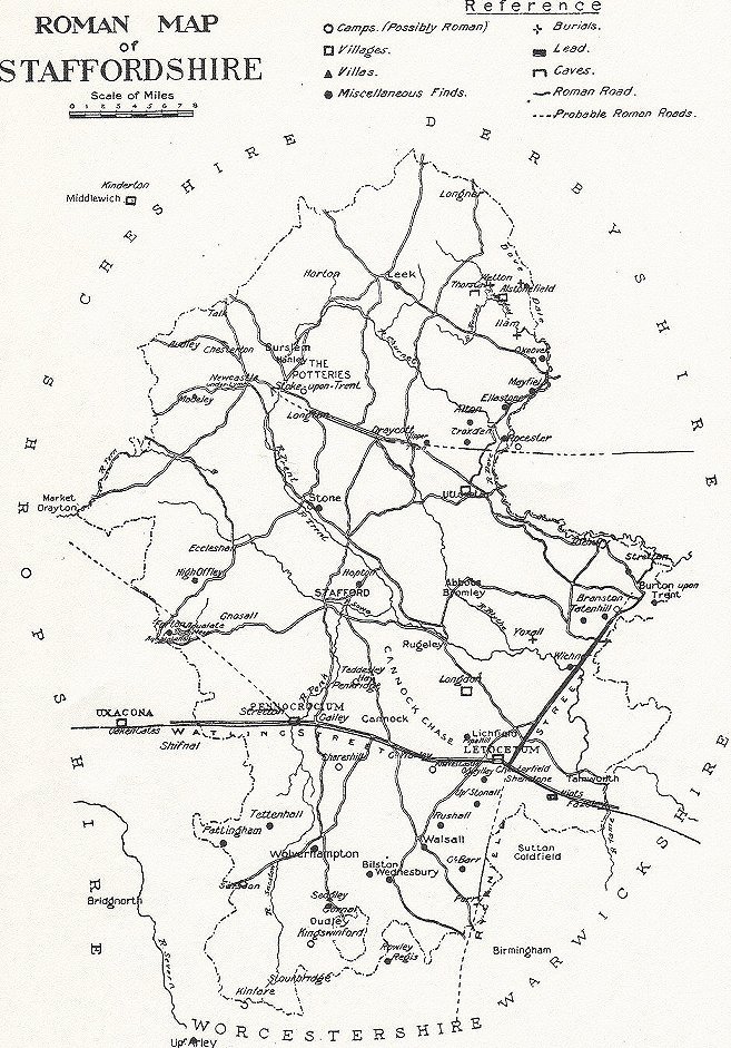
Roman |
Medieval |
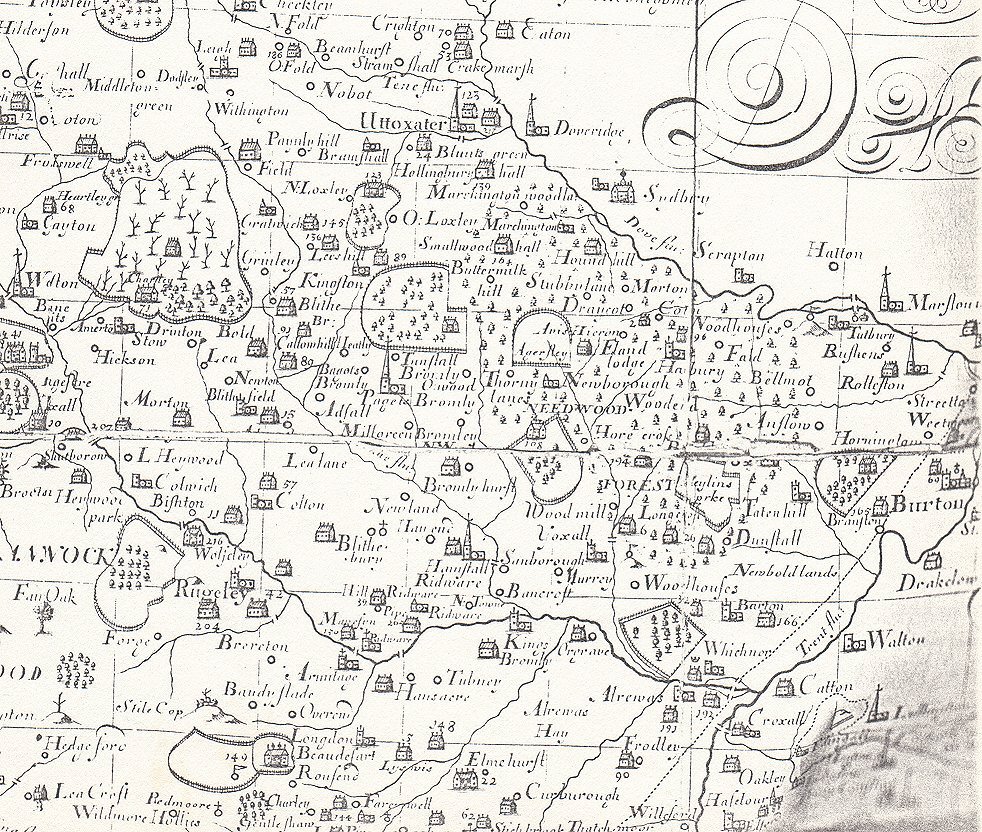
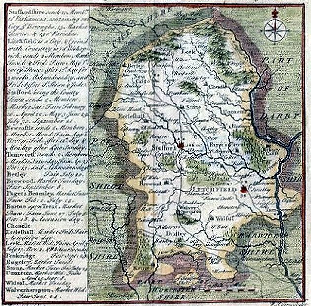
1741 |
||
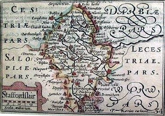
1627 |
|||
1743 |
1795 |
||
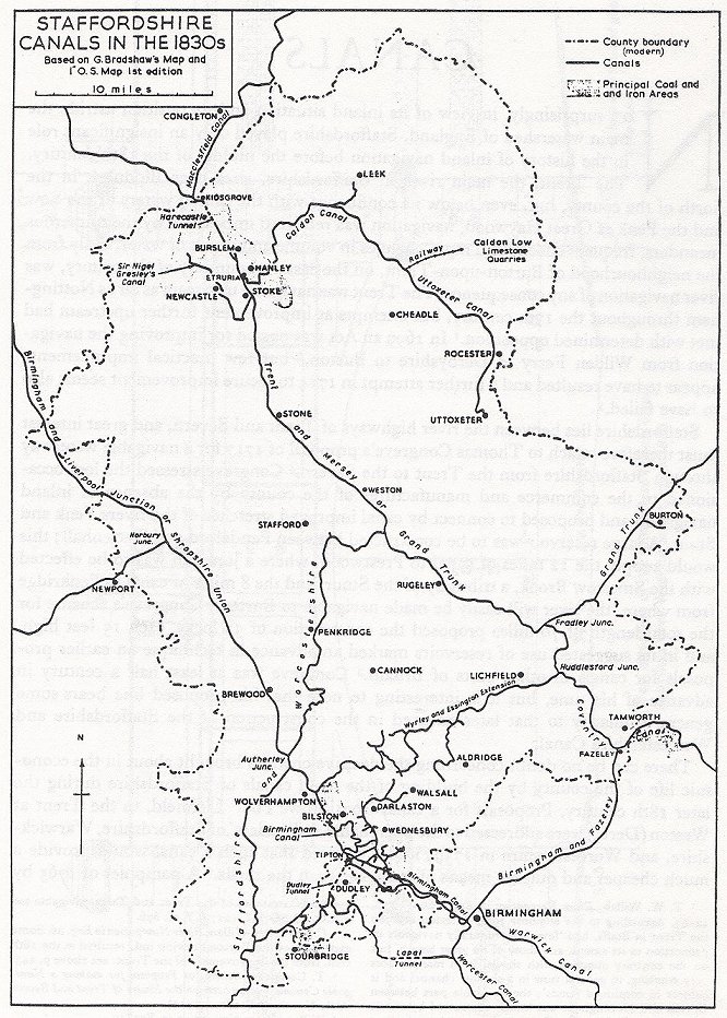
Canals in 1830 |
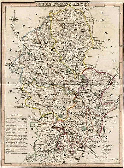
1835 |
1892 |
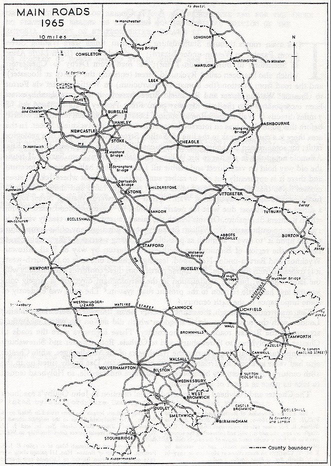
Roads in 1965 |